7391 Highway 16 West, Smithers BC toll free: 1-800-748-2333
Free shipping on orders over $200 with code FREESHIP200 * Some conditions apply
Free shipping on orders over $200 with code FREESHIP200 * Some conditions apply


| Availability: | In stock (5) |
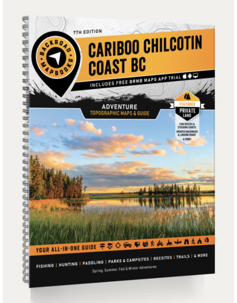
Home to vast stretches of untouched wilderness, the Cariboo Chilcotin Coast is one of Canada’s final frontiers. With towering mountains scraping against the sky, sprawling steppes covered with wildflowers, remote valleys carved by ancient rivers and an untamed ocean coast teeming with wildlife, this region is a backcountry explorer’s dream. Reel in the catch of a lifetime on one of the Fishing Highway’s incredible lakes, explore the bays and inlets around Bella Coola on sea kayaking adventure or get away from it all amid the natural splendour of Tweedsmuir Provincial Park – there is lots to discover in the Cariboo Chilcotin Coast!
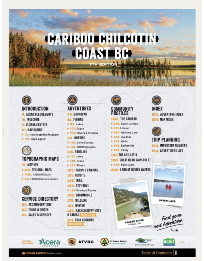
To help you make the most out of your time here, the Backroad Mapbooks team has created the most comprehensive and detailed recreation Mapbook for the region ever! The 7th Edition Cariboo Chilcotin Coast Backroad Mapbook features numerous additions and expansions from their last edition, including labelled fish species, private land, charts for fish stocking and hiking trails, countless new recreational Points of Interest and a brand new Backcountry Huts and Cabins section. Featuring 59 maps at 1:250,000 scale, thousands of detailed Adventure write-ups, an easy-to-use index and much more, this is your ultimate guide to exploring the Cariboo Chilcotin Coast!
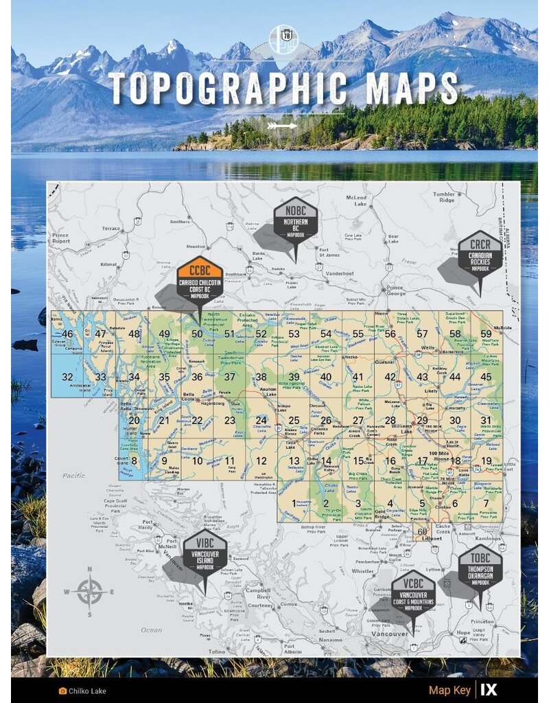
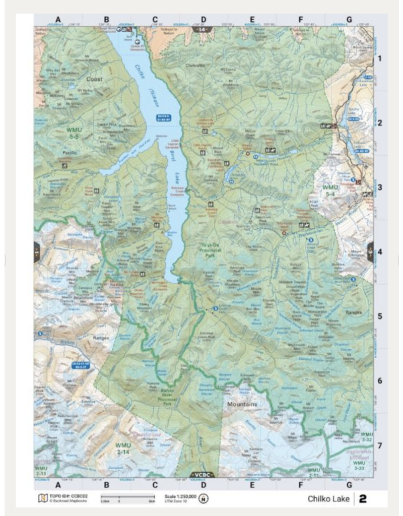
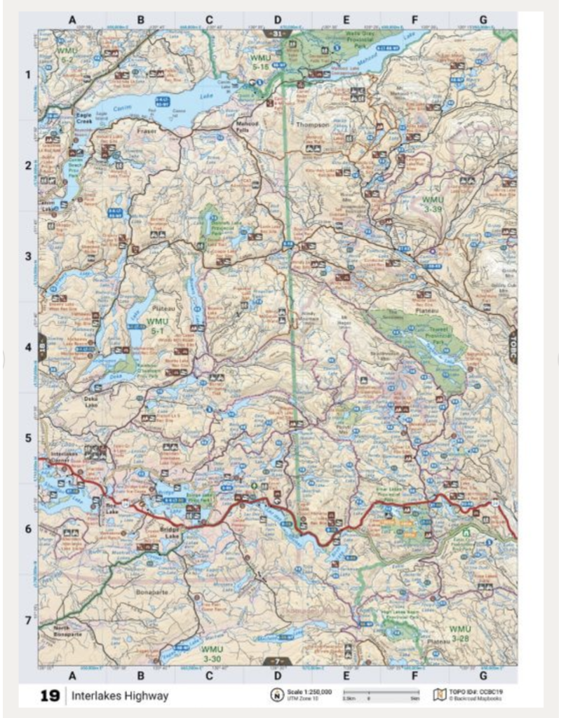
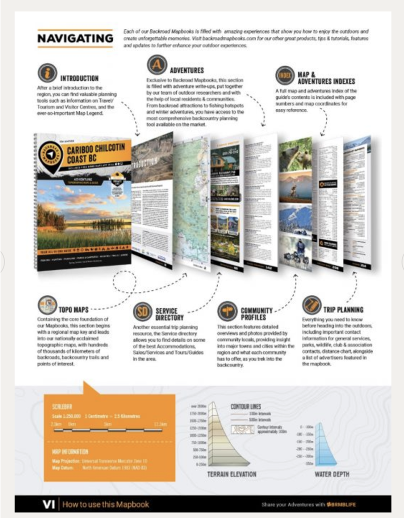
Map Scale & Area
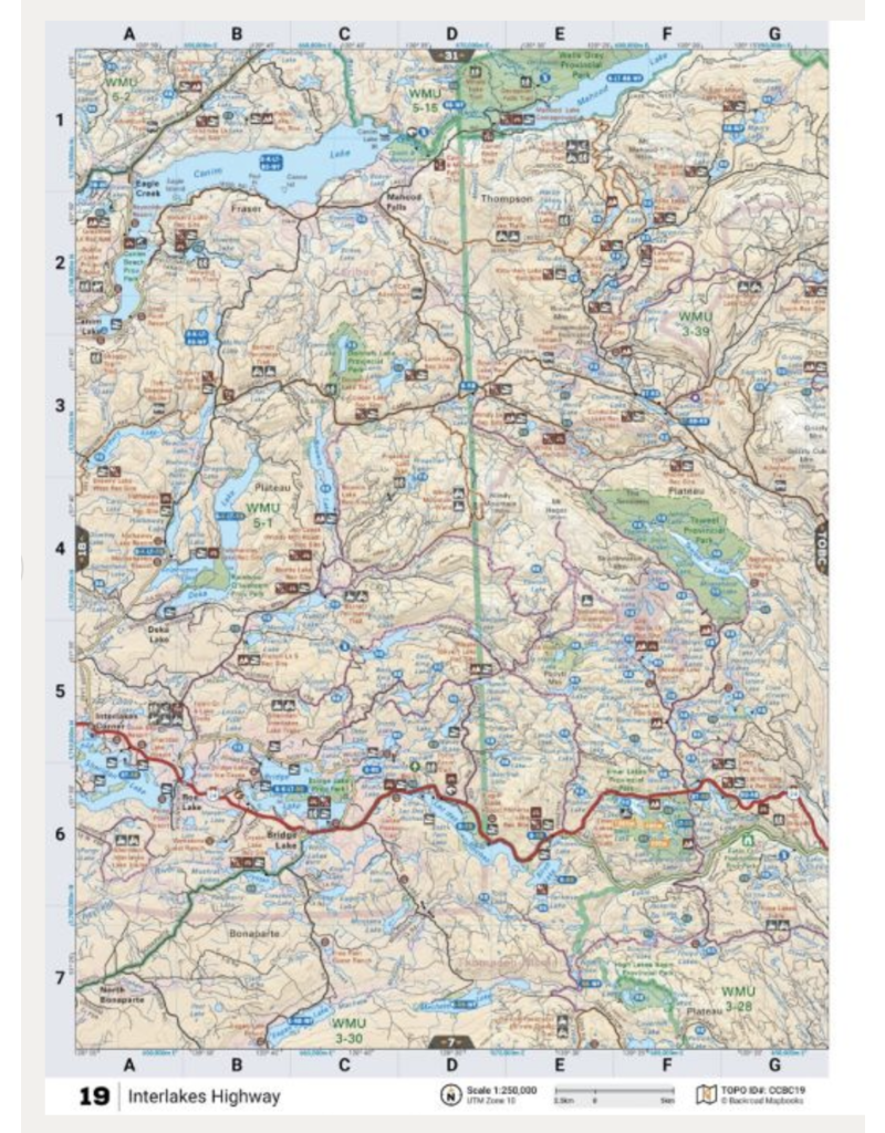
Map Scale: 59 maps @ 1:250,000 + 1 map @ 1:80,000 scale
This mapbook includes 100 Mile House, Alexis Creek, Anahim Lake, Barkerville, Bella Bella, Bella Coola, Bridge Lake, Clinton, Gold Bridge, Horsefly, Likely, Lillooet, McBride, Quesnel, Wells, Williams Lake, & more
Features Included:


