7391 Highway 16 West, Smithers BC toll free: 1-800-748-2333
Free shipping on orders over $200 with code FREESHIP200 * Some conditions apply
Free shipping on orders over $200 with code FREESHIP200 * Some conditions apply


| Availability: | In stock (13) |
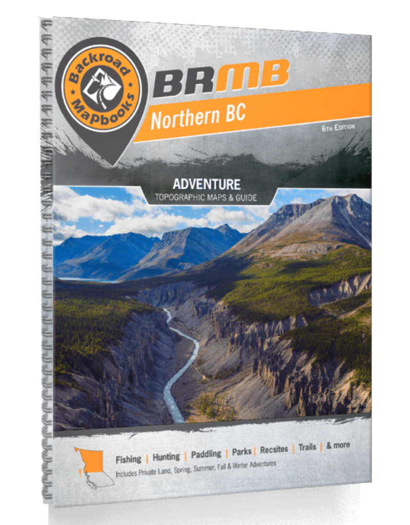
Northern BC - 6th Edition
Backroad Mapbooks
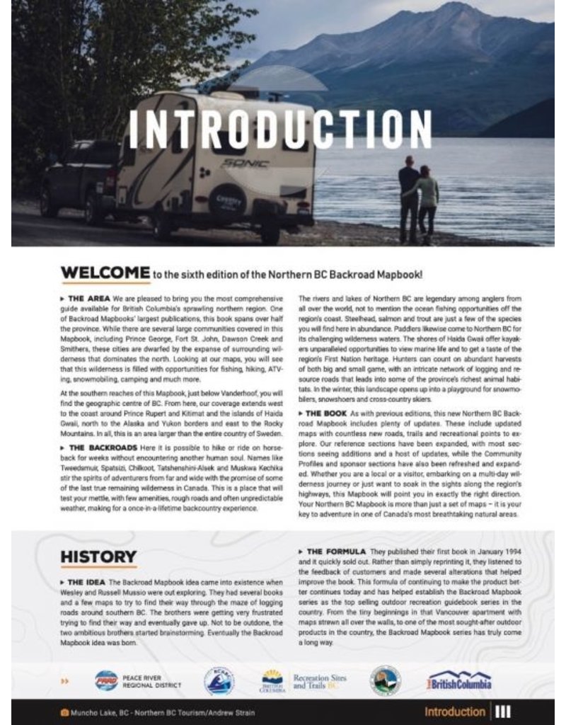
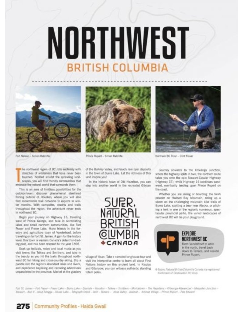
Larger than the entire country of Sweden, Northern BC is an immense sparsely populated region. The port city of Prince Rupert sits nestled among the majestic coast mountains in the west, acting as a gateway to the Pacific Ocean and the majestic islands of Haida Gwaii. To the east, the Rocky Mountains cast their imposing shadow over the land, attracting hikers, mountaineers and ski tourers from far and wide. Whether you are looking to fish, camp, ATV, snowmobile, hit a hot spring, view wildlife or just take in the sights, Northern BC offers an abundance of adventure.
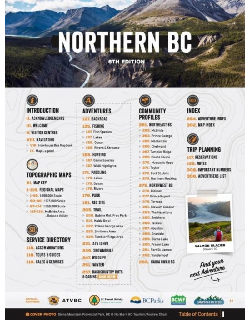
The latest edition of BRMB Northern BC Backroad Mapbook contains numerous updates and expansions to help you navigate this vast area. In addition to expanded road coverage, they have updated the motorized and multi-use trails, added more fish species to many lakes and rivers and included countless new Points of Interest. They have also included refined private land areas, an updated McBride area map and expanded the Adventures listings with additions to each section. The Backcountry Huts and Community Profiles sections are back and bigger than ever, while the Fish Stocking and Trails Charts have been updated and refined.
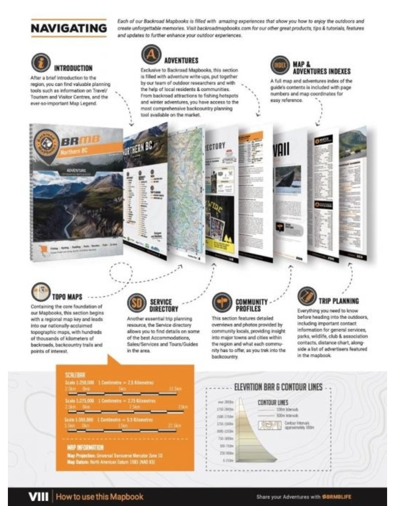
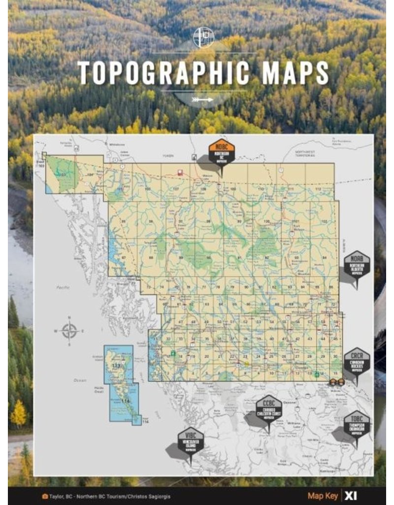
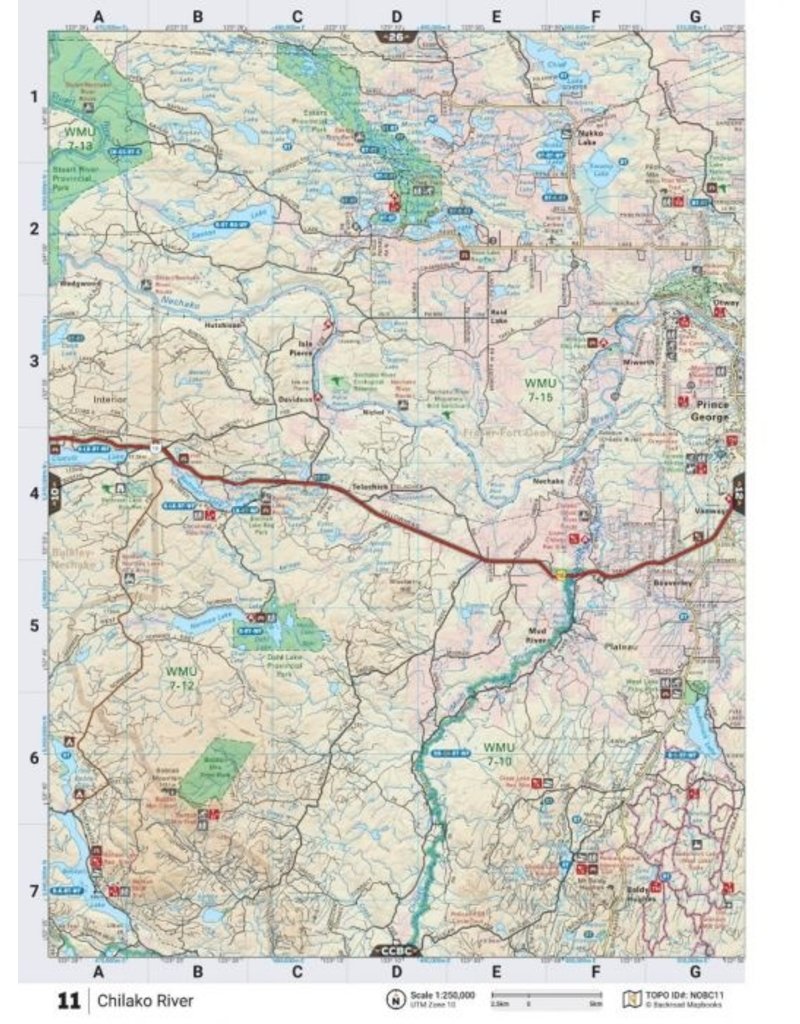
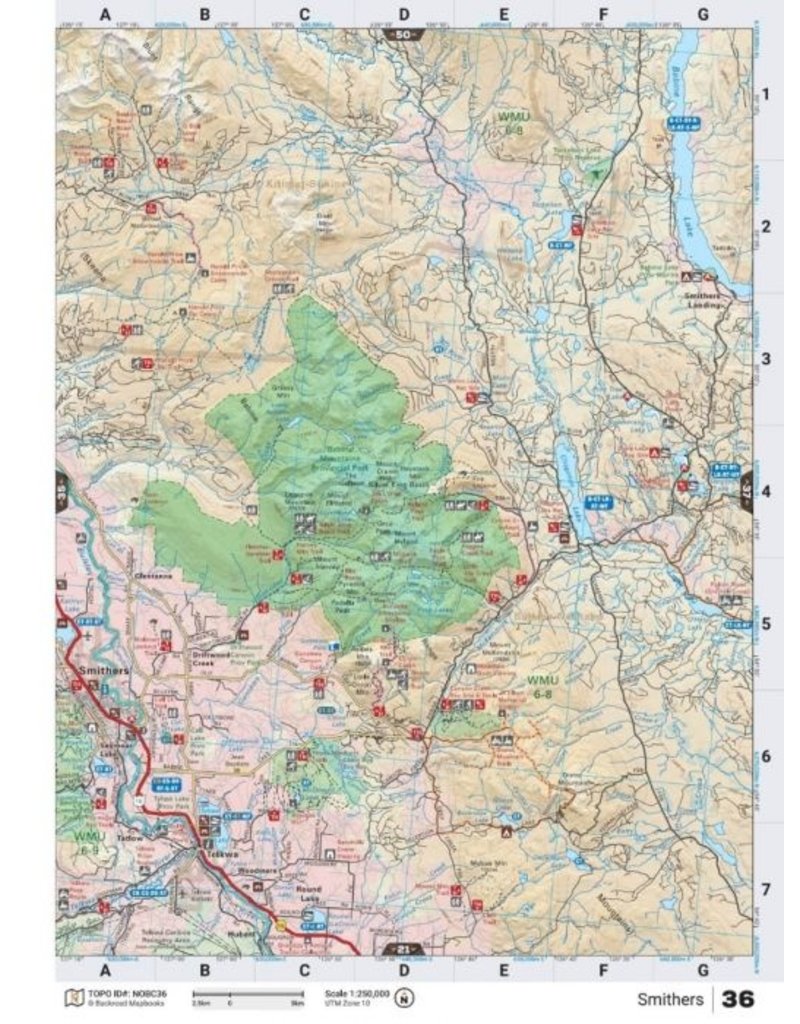
The printed version of the mapbook comes in the convenient 21.5 x 28 cm (8.5 x 11 inch) mapbook format with a heavy-duty spiral-bound cover. The 320-page book includes 114 maps starting at 1:250,000 scale, along with 12 Outdoor Adventure sections, a Service Provider Directory, Map and Adventure Index, Trip-Planning tools and more. With over 240,000 kilometres of roads to view including the most complete logging and industrial road coverage available, the books are ideal for navigating on road trips and planning from home.
Features:
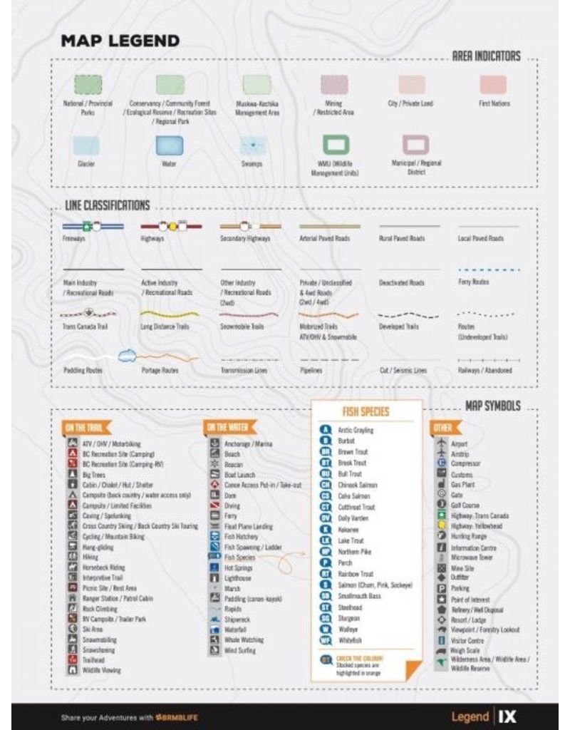
Map Features: Highways, Logging Roads, Land & Water Features, Parks, Adventure Points of Interest, Campgrounds, Hiking Trails, Motorized Trails, Paddling Routes, Hunting & Fishing Areas, Winter Recreation and more
Areas Covered: Atlin, Chetwynd, Dawson Creek, Fort Nelson, Fort St. John, Haida Gwaii, Mackenzie, Prince George, Prince Rupert, Smithers, Stewart, Terrace, Tumbler Ridge, Vanderhoof


