7391 Highway 16 West, Smithers BC toll free: 1-800-748-2333
Free shipping on orders over $200 with code FREESHIP200 * Some conditions apply
Free shipping on orders over $200 with code FREESHIP200 * Some conditions apply


| Availability: | In stock (5) |
Northern BC TOPO Map · Folded · Waterproof
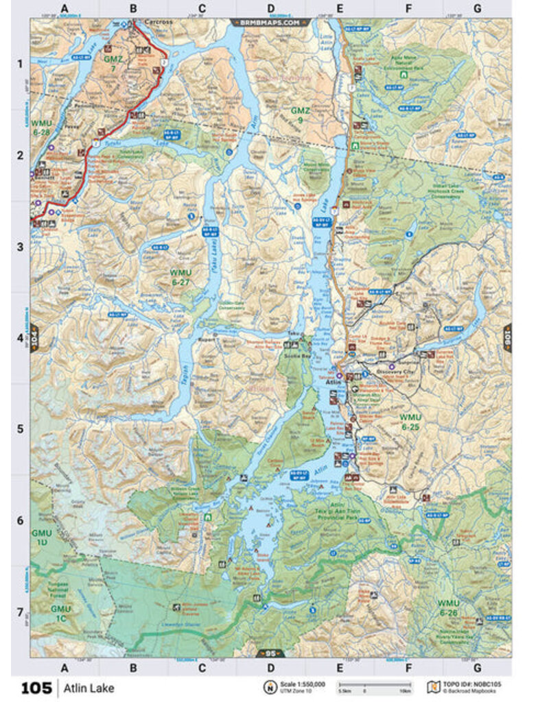
This recreation map for the Atlin area highlights all the logging and resource roads, recreational features and trails for hiking, mountain biking, ATVing, snowmobiling, skiing, snowshoeing, fishing, camping, hunting, canoeing, kayaking, wildlife viewing and more.
New features include private land and labelled fish species, plus new roads, recreational trails and Points of Interest. No other map for the area provides you with this level of recreational or topographic detail.
Measuring 105 x 140 km (65 x 87 mi), this 1:185,000 scale map covers 14,750 km2 (5,695 mi2) in total and includes Atlin, Atlin Prov Park, Atlin Lake, Surprise Lake, Tagish (Taku) Lake, Tutshi Lake, Bennett Lake, Sloko Lake, Fantail Lake, Rupert, Discovery and more!
This map also covers the following Wildlife Management Units: WMU 6-25 Skeena, WMU 6-26 Skeena, WMU 6-27 Skeena, WMU 6-28 Skeena. Atlin - Northern BC is printed on demand at BRMB office in Coquitlam (BC) and measures 61 x 94 cm (24 x 37 inches).
Scale & Dimensions
Area Covered
This map includes Atlin, Atlin Prov Park, Atlin Lake, Surprise Lake, Tagish (Taku) Lake, Tutshi Lake, Bennett Lake, Sloko Lake, Fantail Lake, Rupert, Discovery
Map Features
Highways, Logging Roads, Land & Water Features, Parks, Adventure Points of Interest, Campgrounds, Hiking Trails, Motorized Trails, Paddling Routes, Hunting & Fishing Areas, Winter Recreation and More.


 - Destination Map WP")

