7391 Highway 16 West, Smithers BC toll free: 1-800-748-2333
Free shipping on orders over $200 with code FREESHIP200 * Some conditions apply
Free shipping on orders over $200 with code FREESHIP200 * Some conditions apply


| Availability: | In stock (5) |
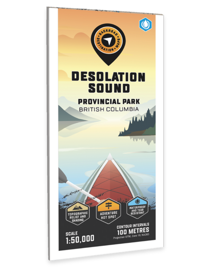
Vancouver, Coast & Mountains BC • Water-Resistant Map
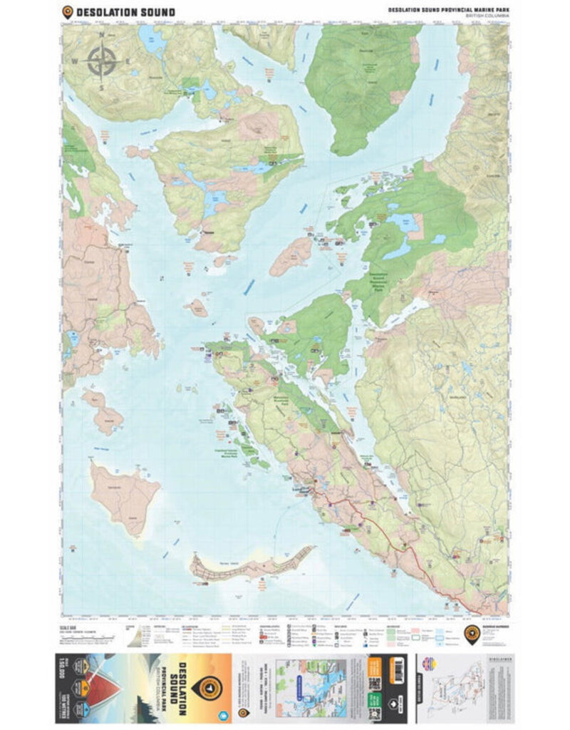
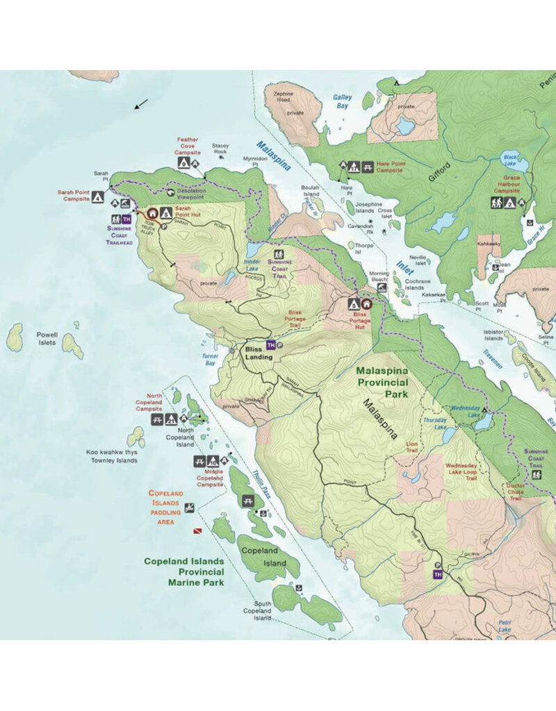
This BRMB Adventure topographic map for the Desolation Sound Area of BC highlights all the islands, channels and inlets, campsites, paddling routes, parks, trails and recreation features in the area. Covering 960 sq. km (370 sq. mi) in total, this map can be used for camping, canoeing, kayaking, exploring, fishing and wildlife viewing, and charts the areas of Desolation Sound Marine Park, Bliss Landing, Copeland Islands Marine Park, Cortes Island, Curme Islands, East Redonda Island, Lund, Malaspina Peninsula, Okeover Inlet, Roscoe Bay, Sarah Point, Savary Island, Sunshine Coast Trail, Tenedos Bay, Unwin Lake, West Redonda Island and more!
The printed version of the map is displayed at 1:50,000 scale on 61 x 94 cm (24 x 37 in) paper.
Print Features:
Specs
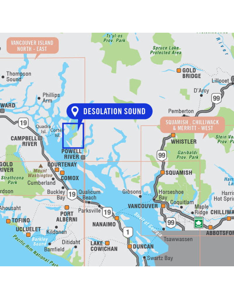
Area Covered
Desolation Sound, Bliss Landing, Copeland Islands Marine Park, Cortes Island, Curme Islands, East Redonda Island, Lund, Malaspina Peninsula, Okeover Inlet, Roscoe Bay, Sarah Point, Savary Island, Sunshine Coast Trail, Tenedos Bay, Unwin Lake, West Redonda
Map Features
Highways, Logging Roads, Land & Water Features, Parks, Adventure Points of Interest, Campgrounds, Hiking Trails, Motorized Trails, Paddling Routes, Hunting & Fishing Areas, Winter Recreation and More.


 - Destination Map WP")


